Physical Map

Southern Europe Physical Map by Diercke Karte FULL CREATION FEBRUARY 2010 |


|
Many of the eventual nomads or colonizers in Southern Europe ended up settling near rivers and other bodies of water because of readily available ability to easily transport items to other countries, and gain access to these countries. The rocky soil mainly found near mountains is simply not suitable for farming, causing many of the early settlers to survive off of being hunters and gatherers. The mountains helped shield these settlers from the harsh northern winds that caused a cooler climate. Many people chose to settle near the Alps due to the rather favorable climate and due of the many rivers that eventually lead to the Mediterranean, Adriatic, and Black Sea. The numerous seas, rivers, and lakes encouraged also the settlers to fish and trade, allowing them to flourish in this environment.
Major Landforms in Southern Europe
1. Albania- Drin River, Aoös River, Shkumbin River, Devoll River, Shkodra Lake, Albanian Alps, Mt. Karabit
2. Andorra- Valira d'Orient River, Madriu River, Valira del Nord River, Gran Valira River, the Pyrenees, Coma Pedrosa
3. Bosnia and Herzegovina- Neretura River, Sava River, Vrbas River, Dinaric Alps, Mt. Maglic, Sava River Valley
4. Croatia- Danube River, Drava River, Krka River, Save River, Velebit Mountains, Dinaric Alps, Lake Vrana, Plitvice Lakes
5. Greece- Acheloos River, Evros River, Pinios River, Volvi Lake, Crete, Evia, Pindus Mountains, Mount Olympus
6. Italy- Po River, Adige River, Tiber River, Adda River, The Alps, Mont Blanc, Como Lake, Garda Lake, Maggiore Lake
7. Malta- (There are no permanent lakes or rivers in Malta) Ta'Zuta, Malta Island, Gozo Island, Comino Island
8. Montenegro- Tara River, Komarnica River, Zeta River, Durmitor Range, Mont Orjen, Mont Lovcen, Bay of Kotor, Lake Skadar
9. Portugal- Douro River, Guadiana River, Morndego River, Tagus River, Serra da Estrela, Pico Volcano, an extension of the Cantabrian Mountains
10. San Marino- Re River, Ausa River, Fiumicello River, Marano River, San Marino River, Appennines Mountains, Mt. Titano
11. Serbia- Danube River, Drina River, Lim River, Morava River, Sava river, Tara River, Dinaric Alps, Balkan Mountains, Palic Lake
12. Slovenia- Drava River, Sava River, Reka River, Idrijaca River, The Alps, Triglav, Julian Range, Savinga Range
13. Spain- Douro River, Ebro River, Jucar River, Tagus River, Cordillera Mountains, Meseta Mountains, Sierra Nevada, Mullhacen, Bay of Biscay
14. The former Yugoslav Republic of Macedonia- Vardar River, Crna River, Bregalnica River, Dinaric Alps, Korab Range, Ohrid Lake, Prespa Lake, Doiran Lake
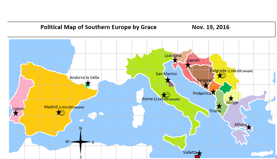
Political Map
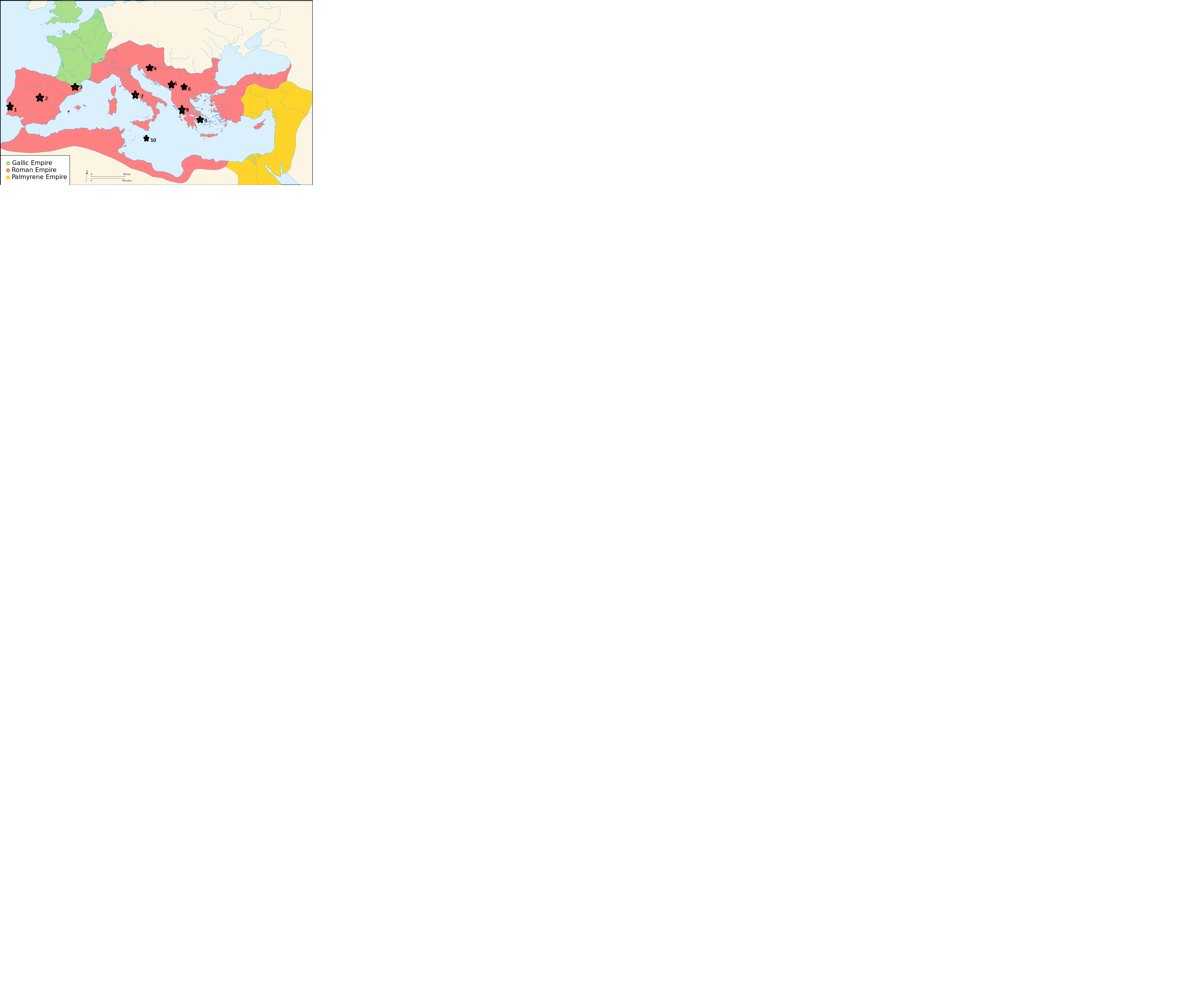
Historical Political Maps


Looking throughout these maps it is evident that during the Ottoman Empire there were "vague" presentations of the country. Leading towards the roman empire these territories have been broken down into smaller parts. These territories have evolved and changed in ways that empires have grown or have shrunken and from looking through these maps, you can see the ones that have thrived and those that have become "extinct". The importance of these historical maps are to show the history of how the country has come to where it is now and to become a part of our world. These historical maps clearly show the world as it was thousands of years ago which is an important aspect of both culture and heritage in southern Europe